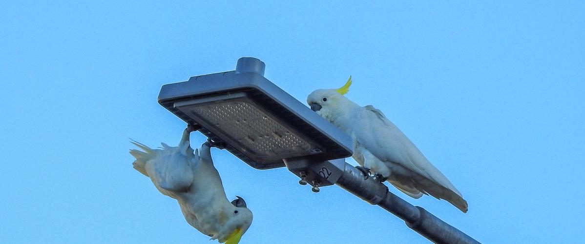
• Studies are also using smartphones to track animals, among them a recent project in Australia, which used low-energy Bluetooth beacons and a crowd-sourced network to monitor the movements of yellow-crested cockatoos.
• The new approach, which respects the privacy of users, only makes use of strictly necessary data. With help from artificial intelligence, it could enable researchers to better understand animal behaviour.
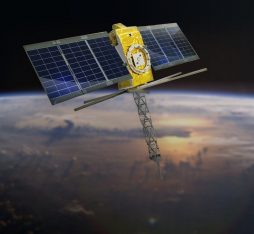
Grouped together, our smartphones are even more powerful than most of us have yet to imagine. Innovative campaigns that make use of thousands of devices belonging to the general public for the participatory production and processing of data and metadata are now opening up new horizons for scientific research. In mid-November, a study conducted by Google Research, in association with Harvard and Colorado universities, broke new ground in measuring conditions in the ionosphere — an upper layer of the Earth’s atmosphere — with information from GPS chips onboard a large number of humble phones. “Although each mobile phone on its own provides noisy readings, we demonstrate that a vast crowdsourced network of aggregated signals can act as a highly sensitive scientific instrument,” explains Google. “We found that mobile phone measurements capture scientifically important features of the ionosphere, providing unprecedented detail in regions with few monitoring stations.” On the ground, the devices that we all carry around in our pockets can also play a valuable role in environmental research and wildlife conservation.
Our system worked as well as — or even better than — the GPS tags that have been used up until now
A smartphone and beacon network
The ability to track animals not only enables us to follow their movements, but also to understand more about their social behaviour and how they adapt to different environments. However, traditional tools for this purpose, such as GPS tags, often have high power requirements and can be costly to deploy. Now a research team led by Damien Farine, an associate professor at the Australian National University and Eccellenza professor at the University of Zurich, has overcome both of these drawbacks with a novel solution based on Bluetooth low-energy (BLE) beacons and a crowdsourced network of mobile phones. The goal of the project was to discover more about sulphur-crested cockatoos living in urban areas of Canberra (Australia). “We attached beacons to the cockatoos that fly around Canberra. The data we collected shows that on average, each of the birds was detected every few minutes. In other words, our system worked as well as — or even better than — the GPS tags that have been used up until now.” Not only did the project reveal a detailed picture of the birds’ movements, but it also pioneered a new technique to track animal populations in urban areas.
Inspired by Apple’s AirTags
As Damien Farine explains, “AirTags leverage information from all connected Apple devices, including iPhones and smartwatches. From the outset, our idea was to test the potential of this network to monitor animals, and in particular in urban areas.” The BLE beacons used by Farine and his team, which are easy to make and cost less than ten euros per unit, emit unique identifying signals that can be detected by nearby devices. These are then uploaded along with relaying devices’ GPS coordinates to the cloud. The resulting solution is sustainable and affordable. “Solutions of this kind always involve a significant measure of compromise. For example, GPS tags are expensive and require a lot of power, which effectively means that they are either too heavy (with large batteries), or that they don’t collect enough data points (with small batteries). Our beacons can collect data for several years with power from a single small battery.”
Respect for privacy
Respect for privacy is one of the main advantages of this technology. “Devices in the network are not identified and only transmit information about the Bluetooth beacons along with timestamps and GPS coordinates. Given that there are a lot of telephone users in urban areas, there are no issues with privacy.” The researcher is already planning on future improvements. “Machine learning is very powerful, and we are only beginning to discover all the possible applications. We would also like our BLE beacons to be combined with other sensors, such as accelerometers … That would enable us not only to locate the animals (with the beacons), but also to know what they are doing wherever they are (with information on their behaviour from the accelerometer).”
Read more :
Crowdsourcing involves outsourcing work to anonymous, voluntary users or members of the crowd. It has become increasingly common since the emergence of Web2.0, which made it easier to involve users in community-driven projects, most notably initiatives to produce information like the navigation and traffic application Waze.

