● Using mobile network signalling metadata, Orange produces highly accurate population mobility statistics, making it possible to distinguish between transport modes and predict atmospheric pollution via the Predict’AIR project.
● To safeguard user privacy and ensure anonymity, these technologies now rely on artificial intelligence to produce synthetic datasets.
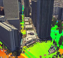
Researchers in Boston are leveraging volunteers’ smartphones to collect data for urban planning. For their study entitled BostonWalks, they deployed a high-precision GPS tracking system to map mobility patterns of residents in the American city. Harvesting real-time information on journeys on foot and public transport, it also provided an unprecedented insight on volunteers’ physical activity and the impact of neighbourhood planning on travel behaviour. Building on the success of the project, these tracking algorithms will provide urban planners with powerful tools to design a healthier, less polluted city that is better adapted to modern lifestyles.
The goal of the Predict’AIR project is to quantify the impact of population flows on polluting emissions so that we can predict air quality while factoring in traffic and weather conditions
Mobility Engine: how Orange network data can predict mobility
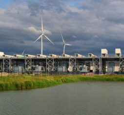
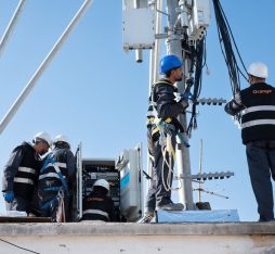
At Orange, the FluxVision project unlocks the value of large-scale mobile signalling to generate population mobility insights. These statistics offer exceptional spatio-temporal accuracy, enabling a seamless transition from macro-level trends to high-resolution granularity. “With advanced propagation models we can refine mobility tracking to achieve a precision of 500m in rural areas and under 200m in cities,” explains Arnaud Legendre, an engineer and data science PhD at Orange. “We now have predictive indicators based on spatio-temporal variables that enable us to provide demographic forecasts by merging multiple data sources.” With its mobility ‘Mobility Engine’, users of the service can now see if commuters are traveling on a rail line or on a nearby road. This is not only crucial information for Orange, but also for public policy makers. “Measures of population mobility are important to telecom operators, who need to improve the quality of their network services: to know, for example, if a dedicated high-speed train antenna is providing adequate coverage for travellers.”
Improving air quality
Data collected can also serve the needs of CSR research. The goal of the Predict’AIR project is to quantify the impact of population flows on polluting emissions so that we can predict air quality while factoring in traffic and weather conditions. “We are collaborating with academic partners such as Mines Paris – PSL and IFPEN on the monitoring of urban logistics using signalling from connected devices (SIM cards) onboard trucks. The goal is to help cities decarbonize freight transport,” explains the researcher. “It’s a critical challenge in a sector that accounts for more than 10% of carbon emissions in France. The analysis of this data will pave the way for more efficient infrastructure planning: for example, by enabling us to determine optimal locations for goods distribution hubs in cities.”
Data privacy
The need to ensure privacy is a critical concern with this type of application. “The law requires us to delete signalling histories within 15 minutes. To comply with this regulation, we use algorithms which generate running totals while erasing personal identifiers.” In other words, AI is deployed to model population flows in real-time, capturing the essential characteristics of the source signalling within profiles that are entirely synthetic and anonymous. The researchers are using red-team simulations to identify any potential vulnerabilities in their system: “We are modelling the impact of sophisticated AI-powered attacks to ensure that no personal information can be extracted from our aggregate results.”