

“Global Forest Watch, updated daily, identifies elements of global forest cover.” “Artificial intelligence can identify the sound of deforestation in a protected area.”
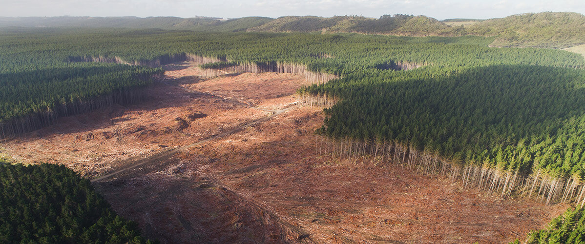
This summer, the whole world watched in horror as thousands of fires, again this year, ravaged the Amazon rainforest. Yet the forests are specific ecosystems: they are carbon sinks, meaning they stock carbon dioxide outside of the atmosphere; their destruction is contributing to climate change. To fight this phenomenon and protect the environment, governments, associations, scientists and local communities are relying more and more on technological advances. More specifically, here’s how satellite imagery, artificial intelligence, and drones are being deployed in environmental battles.
Satellite imagery: eyes in the sky
Combined with other sources of information (data collected in the field, aerial photography, etc.), satellite imagery makes it possible to analyse the evolution of forests, to detect changes that have arisen in a particular area and over a given period of time, and, ultimately, to determine the rate of global deforestation. It also makes it possible to estimate the biomass (the living matter present in a natural environment) and potentially identify invasive species or reveal the impact of certain human activities.
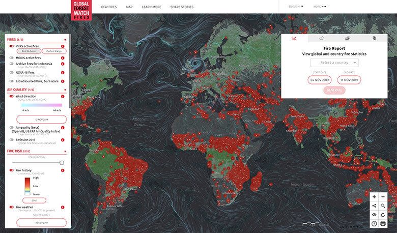
Global Forest Watch (GFW) enables virtually real-time, free access to information on the forests’ situation. It is one of the most comprehensive, precise, and up-to-date global-forest-cover-tracking tools.
GFW compiles data from different partners: satellite images are provided by NASA; Google makes its mapmaking, cloud, and machine learning solutions available; the University of Maryland develops algorithms to determine the decrease in forest cover. Finally, users can contribute to the platform by providing complementary data, participating in the blogs and group discussions, and taking part in the evaluation and validation of satellite observations.
GFW has proved its worth several times. For example, the platform provided data and analyses during the 2015 Southeast Asian haze, enabling the Indonesian authorities to identify the companies responsible for the fires that brought about this air pollution. Multinational companies use it to control their supply chains (for furniture or food products) and ensure that they meet their commitment to “zero deforestation”.
GFW is used in the scope of local initiatives (of participatory mapping for example) and has specific applications, such as GFW Fires for monitoring and fighting forest fires.
Satellite imagery is not only used to monitor forests. It also helps to save animal species. For example, satellite remote sensing provides important data on wildlife, whereas GPS location systems enabling tracking of different species. It is also used for natural resource management, for sustainable development of land, etc.
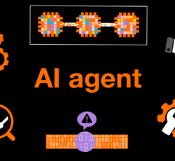
AI is listening to the forest and its inhabitants
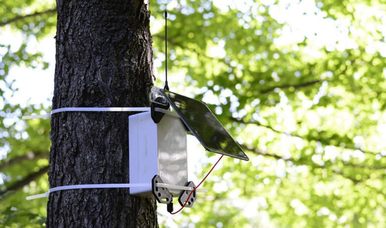
Illegal deforestation has its own sound, especially in a protected area: that of the chainsaws and unauthorised off-road vehicles clearing their way through the vegetation. Covered by the sounds of the forest, this noise sometimes goes unnoticed. However, artificial intelligence can identify the sound of ongoing felling on an audio track. It has become part of the array of techniques that local authorities and indigenous people can deploy against deforestation.
Founded by American engineer Topher White, Rainforest Connection provides the rainforest with ears thanks to recycled old mobile telephones. Installed on trees, the RFCx device is made up of a mobile phone equipped with microphones that pick-up background noise within a radius of up to 1 km. A solar panel system, that is also made from recycled materials, powers the device.
It’s the same principle for Outland Analytics, who have developed a peripheral device using audio recognition algorithms – trained with hundreds of hours of field recordings and public data – to detect early warning signs of deforestation. A single device can monitor up to 90 acres of forest.
Once they have been collected, the sound signals are analysed in real time thanks to TensorFlow, the open source machine learning tool developed by Google. When the noise of an engine is recognised, the device, which is connected to the cellular network, transmits a warning to a server, which sends an email and an SMS to the forest rangers.
Compared with satellite imagery, this technique has the advantage of providing authorities with virtually instant information on vast expanses of forest, enabling them to reduce their response time.
AI can also help to protect endangered animals, in forests and in other ecosystems, by contributing to the fight against poaching or to biological classification. The Topher White system is used, for example, to “recognise patterns of activity linked to poaching”. Among Microsoft’s AI for Earth projects, Wild Me aims to stimulate research on wild animals thanks to computer vision.
Tree-planting drones
Several ambitious reforestation projects are currently underway across the globe. However, to plant millions of trees by hand is a laborious operation, to say the least. Several companies have therefore developed drones to sow packets of seeds, which have certain benefits (speed, cost) compared with traditional methods. The use of machine learning makes it possible to assess conditions on the ground, identify suitable planting sites, monitor the plants’ growth, etc., favouring native species. Startup BioCarbon Engineering, for example, is working with Worldview International Foundation, a non-profit organisation based in Myanmar (formerly Burma), on a degraded mangrove forest restoration pilot project.
First the drones fly over the affected area to map it, collecting data that can be combined with satellite data and analysed to determine the best locations to plant the seeds. They then fire biodegradable pods filled with germinated seeds and nutrients. In theory, ten drones piloted by two operators could plant 400,000 tree seeds per day. The Worldview International Foundation, which also works with Indian farmers to restore mountain forests, wishes to use the same drones in these areas, after the technique has proved successful on a larger scale in Myanmar.
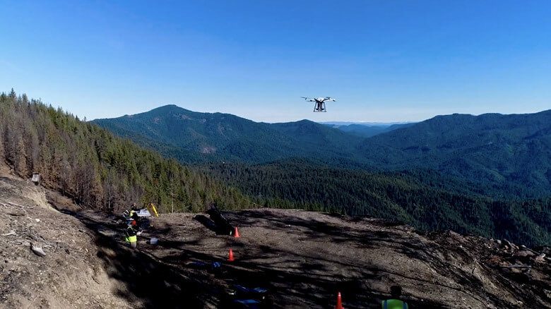
American startup DroneSeed, which operates in the west of the United States, for its part, is looking more specifically at post-fire-tree-planting projects with the help of swarms of drones equipped with multispectral cameras, high-end lidar*, tanks, and dispersal mechanisms. The drones fly over and map the burnt area, enable identification of the places where trees grow best, and deploy packets of seeds and nutrients.
Better natural resource management, monitoring forest cover and living species thanks to satellite imagery; tracking illegal deforestation and protecting animal thanks to machine learning; reforestation with drones, etc. Emerging technologies provide unprecedented possibilities to contribute to the preservation of our ecosystems.
* An alternative to radar using the reflected light of a laser.